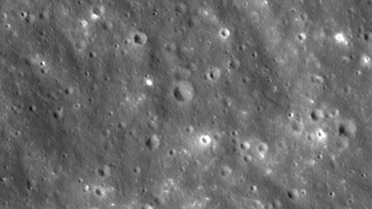
NASA’s Lunar Reconnaissance Orbiter captured images of a new lunar crater created by an impacting SpaceX Falcon 9 upper stage, NASA reported. The rocket body struck the lunar surface on Aug. 5 following its January 2025 launch of the Firefly Blue Ghost 1 mission, and the orbiter photographed the impact site between Aug. 11 and Aug. 12.
Engineers tilted the spacecraft to aim its Narrow-Angle Camera toward the crash location as the orbiter traveled 1 mile per second roughly 60 miles above the Moon. Because the spacecraft orbits from pole to pole every two hours while the Moon rotates beneath it, the team waited six days for the impact site to rotate into view. NASA noted that camera timing required high precision, as snapping an exposure 10 seconds early or late would shift the target 10 miles off-center.
Scientists measured the crater rim at 60 feet across and determined the cavity is less than 10 feet deep based on shadow lengths. The orbiter's Narrow-Angle Camera, capable of resolving details down to 3 feet wide, documented bright and dark rays spreading from the impact. Darker streaks consist of surface dust and rocks weathered by solar wind, galactic cosmic rays, and micrometeorites, excavated from 1.5 feet deep, while brighter streaks near the rim reveal fresh lunar material unearthed from deeper underground.
Independent astronomers first identified the rocket stage's trajectory using publicly available data before NASA’s Center for Near Earth Object Studies refined the path. Based at NASA’s Jet Propulsion Laboratory in Southern California, the planetary defense center calculated the crash coordinates to validate impact prediction techniques, sharing the location data with the Republic of Korea's Korea Pathfinder Lunar Orbiter (Danuri) team.
The Danuri team used its high-resolution LUTI camera to photograph the crater, confirming the trajectory prediction was accurate to about 0.6 miles. Danuri operators then sent the coordinates back to NASA’s LRO team, allowing scientists to compare the new views against pre-impact imagery and pin the crater center at 19.4759°N, 266.7138°E, at an elevation of 511 meters.