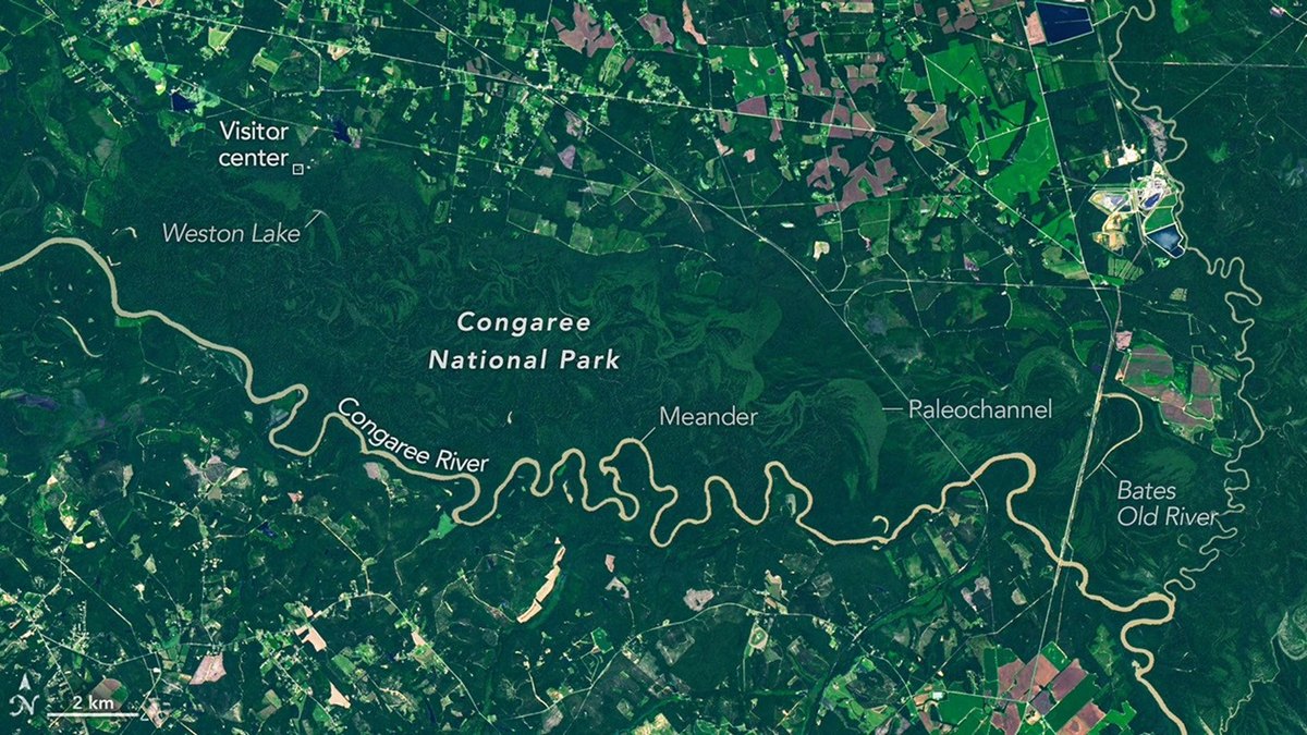
NASA released satellite imagery on Aug. 28 showing the forested floodplains and oxbow lakes of Congaree National Park, captured by the Operational Land Imager on Landsat 9.
The Congaree River floodplain covers 80 percent of the South Carolina park, which contains one of the largest intact tracts of old-growth bottomland hardwood forests in the United States. In the satellite view, curving bands of green trace abandoned channels, ridges, and swales left behind as the river migrated across the plain. Elevation differences across these paleochannels influence flooding frequency, producing distinct forest ecosystems.
Water cuts into outer riverbanks along bends while depositing sediment to form sandy point bars on the inside, severing bends over time to create oxbow lakes. The National Park Service lists Weston Lake, situated 1.2 miles from the visitor center, as one of the park's most permanent oxbow lakes due to its depth and lack of the shallow clay and silt layer found in Devil's Elbow. On the right side of the imagery, Bates Old River spans roughly 4 miles as an abandoned channel, ranking among South Carolina's longest oxbow lakes.
Loggers entered the Congaree basin in the 1880s, but muddy roads, mosquitoes, and frequent floods prevented widespread tree clearance. Conservationists recognized the rarity of the intact bottomland tract by the 1950s. Congress designated the area a national monument in 1976 before establishing it as a national park in 2003.
The river overflows its banks several times each year during winter, spring, and post-storm periods in summer and fall. These floods distribute nutrient-rich silt across the plain, feeding large champion trees. Record-holding specimens recorded in the park include the possumhaw, water hickory, loblolly pine, laurel oak, swamp tupelo, and sweetgum.