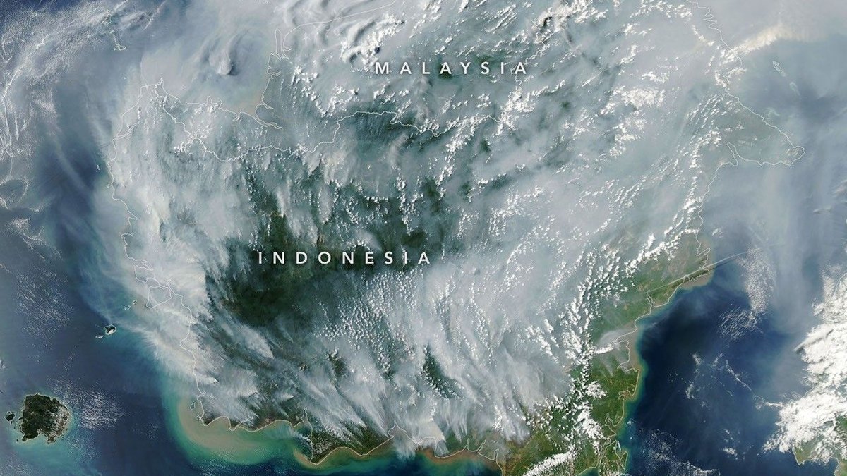
NASA reported that satellite sensors detected hundreds of thermal anomalies across Indonesia as drought dried out wetland soils and fueled smoldering underground peat fires. The agency's Aqua satellite captured imagery of the active burning on September 1, 2026, using its Moderate Resolution Imaging Spectroradiometer (MODIS).
Columbia University researcher Robert Field said fire activity is climbing sharply about three weeks into the season, matching patterns seen during the 2015 burning season. Data from the Indonesian meteorological agency showed that roughly 90 percent of the country received little to no rainfall in early August, driven by a strengthening El Niño and a positive phase of the Indian Ocean Dipole. Field noted that while surface fires are easier to control, underground peat fires in Kalimantan, Sumatra, and Papua typically burn until seasonal rains arrive in October or November.
By September 2, the 2026 fires had released roughly 10 percent of the greenhouse gas volume emitted during Indonesia's 2015 season, which totaled 1.75 billion tons of greenhouse gas equivalents. Indonesia holds roughly 36 percent of the world's tropical peatlands. Estimates cited by NASA indicate tropical peat fires produce three times more fine particulate matter, five times more sulfur dioxide, three times more organic carbon, and twice as much methane and carbon monoxide as other tropical forest fires.
Indonesia's Ministry of Forestry tallied 946 hotspots on August 31, 2026, using its SiPongi monitoring system, which relies on MODIS and VIIRS satellite sensors. University of Maryland ecologist Mark Cochrane noted that heavy smoke, clouds, and subterranean burning conceal thermal signals, which can paradoxically cause satellite fire counts to drop during the most severe smoke events. Cochrane added that canal construction and drainage from 1990s agricultural projects lowered water tables across the region, while plantation forestry and oil palm operations expanded flammability.
University of Maryland researcher Shi Jun Wee is working with NASA and MapBiomas to develop algorithms that use shortwave infrared data from Landsat and Sentinel-2 satellites to identify understory fires missed by current sensors. News reports confirmed that hazardous smoke has forced some Indonesian schools to shift to remote learning, closed nine national parks, and delayed commercial flights.