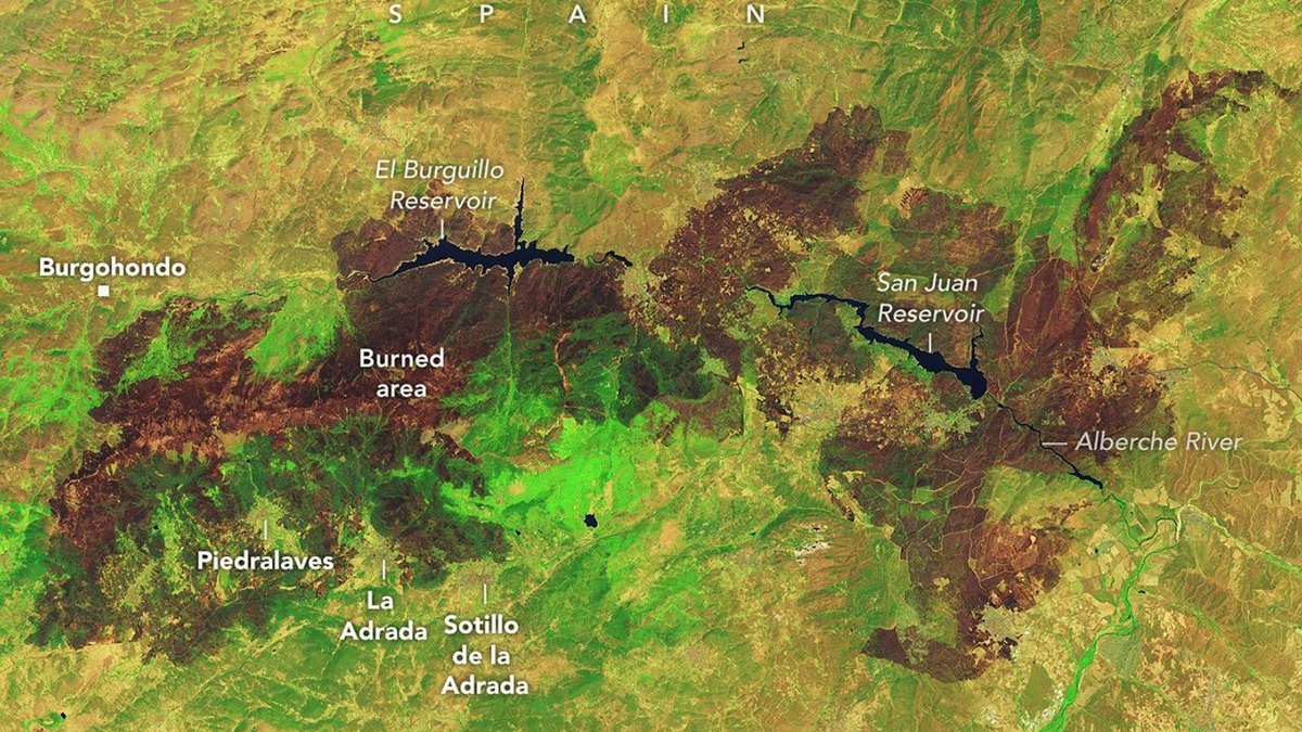
Wildfires across Spain and France burned tens of thousands of hectares in July 2026, forcing hundreds of thousands of residents to evacuate and destroying hundreds of homes. NASA reported that the blazes were among the most severe and disruptive to hit both countries in decades.
In Spain, a wildfire near Burgohondo in Ávila province burned approximately 50,000 hectares, making it the largest fire on record in Spanish history. NASA satellites first detected the blaze on July 22 and July 23 before it merged with neighboring fires on July 24, expanding the total burned landscape to 77,000 hectares. Flames swept through homes, campgrounds, restaurants, and marinas surrounding two major reservoirs in the area.
In France, fires destroyed more than 90,000 hectares across the country by late July, according to figures from the European Forest Fire Information System. A single blaze west of Bordeaux burned over 42,000 hectares and devastated the village of Le Porge. On July 25, French firefighters reported a pyrocumulonimbus, a towering heat-driven cloud, marking the first time a wildfire in France has produced such an atmospheric event.
Researchers with The State of Wildfires Project found that an unusually wet winter promoted dense vegetation growth before heat waves and drought dried out the land. Strong winds reaching 65 kilometers per hour then rapidly fanned the flames across both nations. Thousands of firefighters and military personnel constructed firebreaks using bulldozers and hand tools while aircraft dropped water and flame retardant to suppress the blazes.
Crews gained the upper hand by late July, allowing local authorities to begin lifting evacuation orders. However, forecasters warned that fire risks remain elevated due to persistent heat. Government satellite data, including NASA's Fire Information for Resource Management System and Worldview browser, remain active to monitor emerging wildfire activity and track burn behavior.