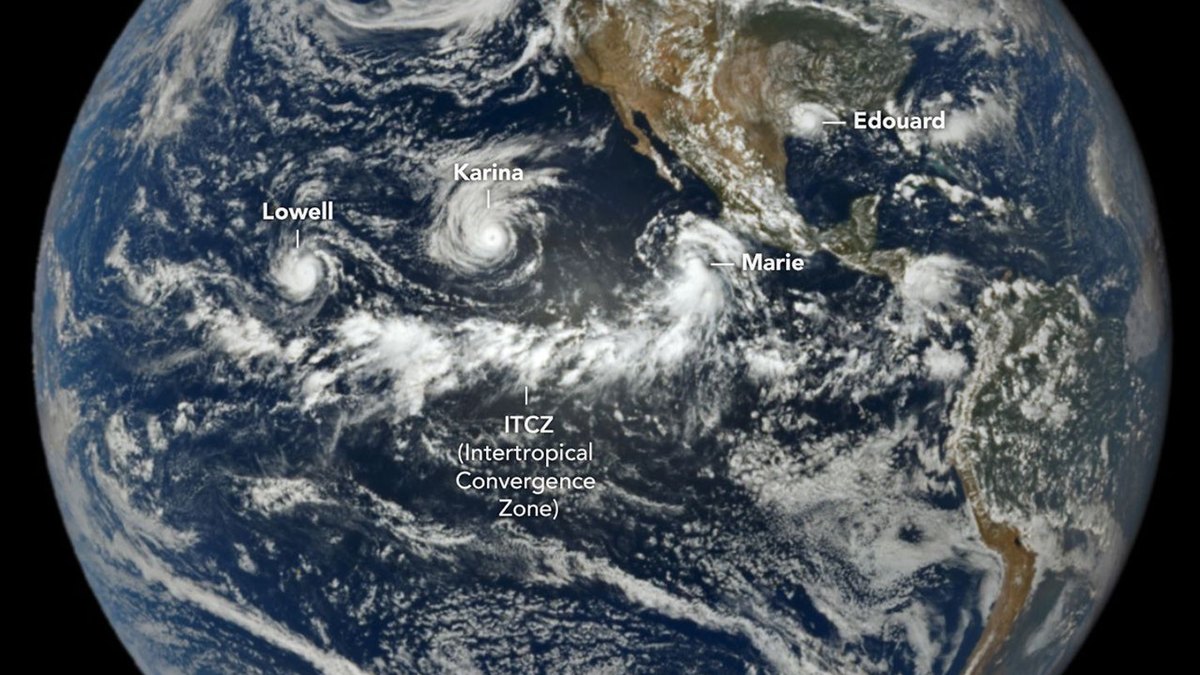
NASA’s DSCOVR spacecraft captured three tropical cyclones spinning simultaneously across the Pacific Ocean on September 1, 2026, according to observations published by the agency.
The Earth Polychromatic Imaging Camera (EPIC) aboard the spacecraft recorded the scene at 1:14 p.m. Pacific Daylight Time (20:14 Universal Time). DSCOVR was operating nearly 1 million miles from Earth and just under 93 million miles from the Sun when it took the image. A band of clouds and thunderstorms associated with the Intertropical Convergence Zone appeared directly south of the systems.
Lowell became the strongest of the Pacific trio, reaching category 5 intensity for several hours on September 2. Around that time, Karina achieved category 4 strength a few thousand kilometers to the east, creating a rare instance of simultaneous category 4 and category 5 hurricanes in the region. Marie, located southwest of Baja California, was a tropical storm when EPIC imaged it, gaining strength as it moved northwest.
Tropical Storm Edouard also appeared in the Atlantic view over Louisiana and Texas shortly after landfall. The short-lived system downed trees and power lines, with National Weather Service meteorologists reporting localized rainfall totals between 15 and 24 inches (38 to 61 centimeters).
Forecasters in spring 2026 had anticipated heavy Pacific activity and a quiet Atlantic because an active El Niño warms eastern Pacific waters while increasing Atlantic wind shear. By September 3, the Northeast Pacific had generated 15 named storms and six hurricanes, reaching an accumulated cyclone energy (ACE) index of 130—about 50 percent above normal. The Atlantic basin had recorded five named storms and zero hurricanes, with an ACE index of 4.4, or about 9 percent of normal, according to Colorado State University meteorologists.
NASA platforms supply Earth-observation data to assist with storm tracking, emergency preparedness, and damage assessment. Users can monitor active hurricanes and inspect related agency data products through the Events tab on NASA’s Worldview browser.