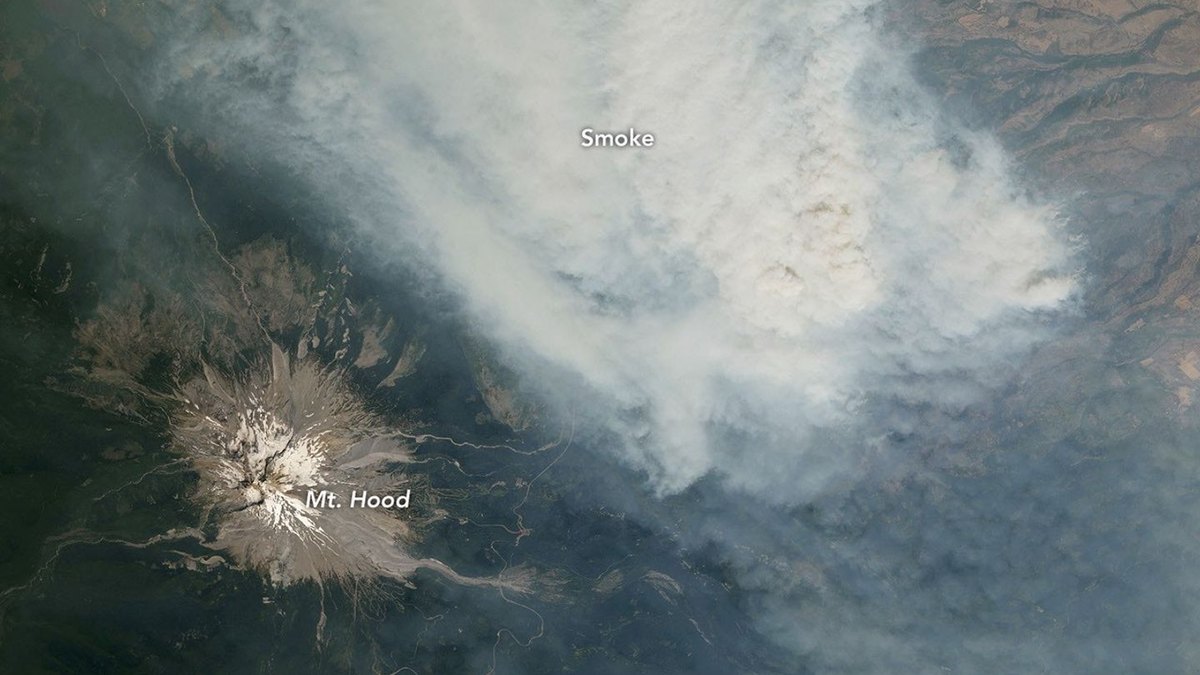
Astronauts aboard the International Space Station photographed thick wildfire smoke surrounding Mount Hood and Mount Rainier across late July and early August 2026, according to imagery published by NASA.
A July 31 photograph captured a dense plume from Oregon's Grasshopper fire near Mount Hood, the state's highest peak at 11,249 feet. A lightning strike ignited the blaze on July 23, and hot, dry conditions pushed the fire across Mount Hood National Forest. By August 12, the fire burned nearly 84,000 acres, prompting evacuation orders in Wasco County and evacuation warnings for the town of Dufur.
Roughly 100 miles north in Washington, an August 4 photograph showed Mount Rainier wreathed in smoke carried by easterly winds from fires across central and eastern parts of the state. The National Park Service noted that fine particulate matter pushed park air quality to unhealthy levels that day. Several days later, officials observed the Grand Park 2 fire burning within park boundaries roughly 3 miles north of the Sunrise Visitor Center, charring 223 uncontained acres by August 12.
The National Interagency Fire Center projected that above-normal fire potential would persist across the Northwest through August due to El Niño-influenced warm weather and dry fuels. Expedition 75 crew members captured the photos using a Nikon Z9 digital camera with a 400-millimeter lens, with data processed and made public by the Earth Science and Remote Sensing Unit at NASA Johnson Space Center.